Anchor
Mihu Trail
Updated:2025-05-01
Popularity 7084


基本資料
步道長度: 2.30 km
步行時間: About 120 minutes
挑戰等級: Level 2 (Advance level)
海拔高度: About 1,100-1,400m
路面狀況: RC Faux wood
步道簡介
◼️Entrance/Exit-A: Provincial Highway 18 at the 66 kilometers point, GPS: 23°28'37.6"N 120°43'01.7"E
◼️Entrance/Exit-B: County Highway 169 – 24.5 kilometer point, GPS: 23°27'45.5"N 120°42'41.4"E
Because the trail runs along Miyang River and a section of the old trail leads to Hudi Tribal Village, the optimistic Tsou people took the “mi” sound from “Miyang”, the “hu” sound from “Hudi”, and renamed Miyangxi Trail to Mihu Trail.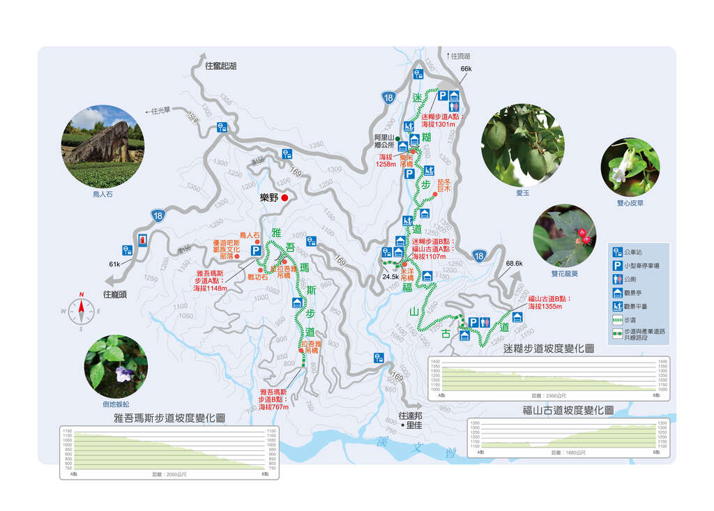
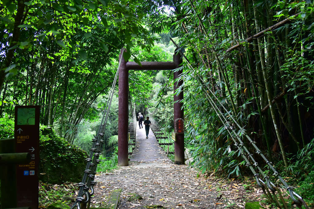
The trail runs roughly along Miyangxi and Lake Youyou Tribal Liason Road in front of Alishan Township Office. Along the trail is Lemi Suspension Bridge, and on one end is Alishan Township Office. Going through Miyang Suspension Bridge in the south side leads you to County Highway 169. Continuing south will lead to Fushan Ancient Trail.

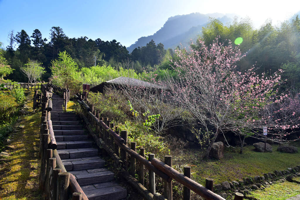
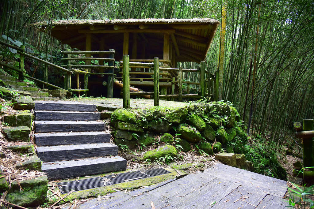
Mihu Trail is paved with RC faux wood on the flat part of the trail and wood on the steps. Aside from a few steep sections, the rest of the trail is quite easy. The scenery along the way - dense bamboo forest, mixed trees forest, and a small bridge over a gentle stream – all contribute to a serene and relaxing atmosphere.
◼️Entrance/Exit-B: County Highway 169 – 24.5 kilometer point, GPS: 23°27'45.5"N 120°42'41.4"E
Because the trail runs along Miyang River and a section of the old trail leads to Hudi Tribal Village, the optimistic Tsou people took the “mi” sound from “Miyang”, the “hu” sound from “Hudi”, and renamed Miyangxi Trail to Mihu Trail.
The trail runs roughly along Miyangxi and Lake Youyou Tribal Liason Road in front of Alishan Township Office. Along the trail is Lemi Suspension Bridge, and on one end is Alishan Township Office. Going through Miyang Suspension Bridge in the south side leads you to County Highway 169. Continuing south will lead to Fushan Ancient Trail.
Mihu Trail is paved with RC faux wood on the flat part of the trail and wood on the steps. Aside from a few steep sections, the rest of the trail is quite easy. The scenery along the way - dense bamboo forest, mixed trees forest, and a small bridge over a gentle stream – all contribute to a serene and relaxing atmosphere.
How to Get There
Choose a transportation method based on your departure location.